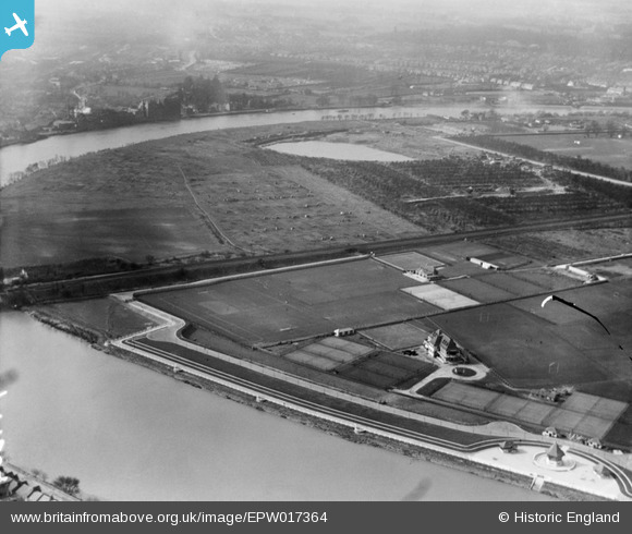
EPW017364 ENGLAND (1927). Riverside sports grounds, Chiswick, 1927
© Copyright OpenStreetMap contributors and licensed by the OpenStreetMap Foundation. 2025. Cartography is licensed as CC BY-SA.
Details
| Title | [EPW017364] Riverside sports grounds, Chiswick, 1927 |
| Reference | EPW017364 |
| Date | 3-March-1927 |
| Link | |
| Place name | CHISWICK |
| Parish | |
| District | |
| Country | ENGLAND |
| Easting / Northing | 521127, 176502 |
| Longitude / Latitude | -0.25573874816749, 51.474010543284 |
| National Grid Reference | TQ211765 |
Pins

John Ray |
Friday 14th of June 2013 08:21:02 PM | |

SteveP |
Thursday 16th of August 2012 08:47:21 AM | |

Captain EJ |
Friday 20th of July 2012 11:14:31 PM | |
Wrong. Cubitts Yacht Basin was up river of Chiswick Bridge. |

Wordy |
Saturday 3rd of May 2014 06:40:27 PM |
This is the gravel and ballast pit. |

Wordy |
Sunday 4th of May 2014 06:19:21 PM |

John Ray |
Thursday 28th of June 2012 11:19:56 PM | |

John Ray |
Thursday 28th of June 2012 11:16:56 PM | |

John Ray |
Thursday 28th of June 2012 11:14:57 PM |


![[EPW017364] Riverside sports grounds, Chiswick, 1927](http://britainfromabove.org.uk/sites/all/libraries/aerofilms-images/public/100x100/EPW/017/EPW017364.jpg)
![[EPW017365] Riverside sports grounds and environs, Chiswick, 1927](http://britainfromabove.org.uk/sites/all/libraries/aerofilms-images/public/100x100/EPW/017/EPW017365.jpg)
![[EPW025846] Chiswick, the Oxford and Cambridge Boat Race at Barnes Bridge, 1929](http://britainfromabove.org.uk/sites/all/libraries/aerofilms-images/public/100x100/EPW/025/EPW025846.jpg)