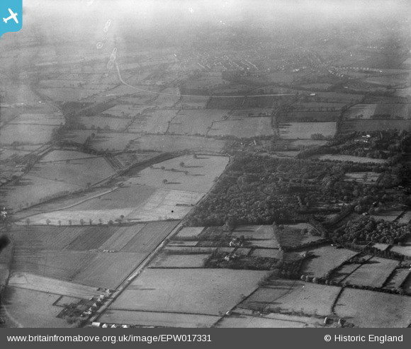
EPW017331 ENGLAND (1926). Taylor's Shrubbery, Stoneleigh, from the south-east, 1926
© Copyright OpenStreetMap contributors and licensed by the OpenStreetMap Foundation. 2026. Cartography is licensed as CC BY-SA.
Details
| Title | [EPW017331] Taylor's Shrubbery, Stoneleigh, from the south-east, 1926 |
| Reference | EPW017331 |
| Date | November-1926 |
| Link | |
| Place name | STONELEIGH |
| Parish | |
| District | |
| Country | ENGLAND |
| Easting / Northing | 520951, 164735 |
| Longitude / Latitude | -0.26228872064522, 51.368280772672 |
| National Grid Reference | TQ210647 |
Pins

Andrew Stainer |
Sunday 7th of October 2012 06:23:15 PM | |

Andrew Stainer |
Sunday 7th of October 2012 06:21:59 PM |


![[EPW017331] Taylor's Shrubbery, Stoneleigh, from the south-east, 1926](http://britainfromabove.org.uk/sites/all/libraries/aerofilms-images/public/100x100/EPW/017/EPW017331.jpg)
![[EPW038135] Cierva Autogiro G-ABUD above Taylor's Shubbery on Epsom Derby Day, West Ewell, 1932](http://britainfromabove.org.uk/sites/all/libraries/aerofilms-images/public/100x100/EPW/038/EPW038135.jpg)