
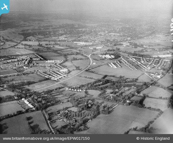
EPW017150 ENGLAND (1926). The Kingston Bypass and environs, New Malden, from the south-west, 1926
© Copyright OpenStreetMap contributors and licensed by the OpenStreetMap Foundation. 2026. Cartography is licensed as CC BY-SA.
Nearby Images (3)
EPW017150

EPW020676

EPW020673

Details
| Title | [EPW017150] The Kingston Bypass and environs, New Malden, from the south-west, 1926 |
| Reference | EPW017150 |
| Date | October-1926 |
| Link | |
| Place name | NEW MALDEN |
| Parish | |
| District | |
| Country | ENGLAND |
| Easting / Northing | 521980, 167658 |
| Longitude / Latitude | -0.24650843500016, 51.394333957785 |
| National Grid Reference | TQ220677 |
Pins

mike |
Friday 12th of August 2022 03:21:12 PM | |
|
mike |
Friday 12th of August 2022 03:18:22 PM | |
|
mike |
Friday 12th of August 2022 03:18:02 PM | |
|
mike |
Friday 12th of August 2022 03:15:19 PM | |
|
Dom |
Thursday 9th of April 2020 09:55:15 AM | |
|
Dom |
Thursday 9th of April 2020 09:49:26 AM | |
|
Dom |
Tuesday 7th of April 2020 01:52:31 PM | |
|
Dom |
Tuesday 7th of April 2020 01:45:27 PM | |
|
Dom |
Tuesday 7th of April 2020 01:43:16 PM | |
|
Robino |
Sunday 29th of December 2013 12:10:24 PM | |
|
simoncon |
Sunday 10th of February 2013 10:56:52 AM | |
|
MikeBellew |
Monday 16th of July 2012 10:37:43 AM | |
|
MikeBellew |
Monday 16th of July 2012 10:35:43 AM | |
|
MikeBellew |
Monday 16th of July 2012 10:32:47 AM |
User Comment Contributions
Shannon's Corner in middle distance |

Jon |
Wednesday 27th of June 2012 09:04:38 PM |