
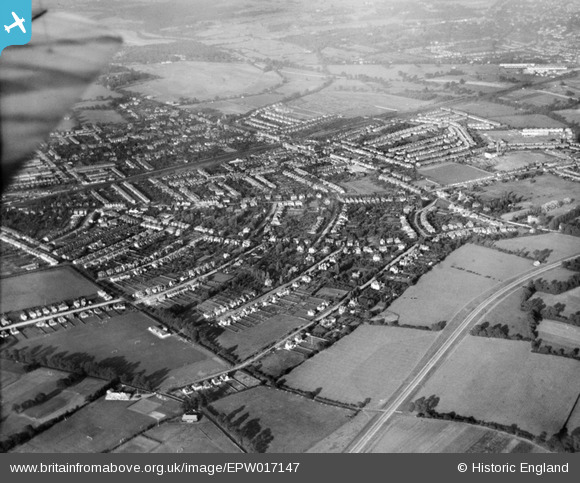
EPW017147 ENGLAND (1926). The town, New Malden, from the south-west, 1926
© Copyright OpenStreetMap contributors and licensed by the OpenStreetMap Foundation. 2026. Cartography is licensed as CC BY-SA.
Nearby Images (3)
EPW017147

EPW017336

EPW017146

Details
| Title | [EPW017147] The town, New Malden, from the south-west, 1926 |
| Reference | EPW017147 |
| Date | October-1926 |
| Link | |
| Place name | NEW MALDEN |
| Parish | |
| District | |
| Country | ENGLAND |
| Easting / Northing | 520883, 167513 |
| Longitude / Latitude | -0.26231963531697, 51.393265454248 |
| National Grid Reference | TQ209675 |
Pins

Johnbg1948 |
Friday 16th of April 2021 08:28:22 PM | |
|
@JohnSouthsea |
Thursday 4th of June 2020 02:02:28 PM | |
|
@JohnSouthsea |
Thursday 4th of June 2020 02:01:35 PM | |
|
@JohnSouthsea |
Thursday 4th of June 2020 02:00:53 PM | |
|
@JohnSouthsea |
Thursday 4th of June 2020 01:59:55 PM | |
|
David |
Monday 6th of April 2015 07:10:43 PM | |
|
mike |
Friday 30th of January 2015 05:53:59 PM | |
|
mike |
Friday 30th of January 2015 05:52:53 PM | |
|
Tom |
Wednesday 19th of November 2014 09:35:35 PM | |
|
Tom |
Wednesday 19th of November 2014 09:35:02 PM | |
|
Tom |
Wednesday 19th of November 2014 09:34:10 PM | |
|
mike |
Friday 21st of February 2014 08:25:22 PM | |
|
mike |
Friday 21st of February 2014 08:22:59 PM | |
|
mike |
Friday 21st of February 2014 08:22:29 PM | |
|
mike |
Friday 21st of February 2014 08:21:52 PM |
User Comment Contributions
Does anyone have any information as regards to the houses on Westbury Road, namely 95 and 93 or 97. Much appreciated if any info can be given. Thanks - Tom |
Tom |
Wednesday 19th of November 2014 09:25:04 PM |