
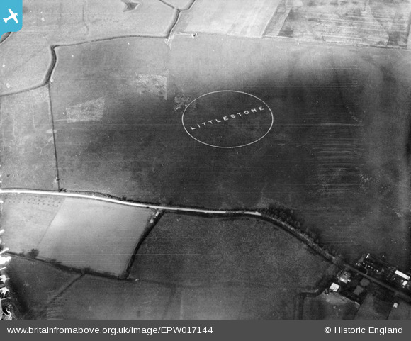
EPW017144 ENGLAND (1926). Littlestone Airfield, St Mary's Bay, 1926
© Copyright OpenStreetMap contributors and licensed by the OpenStreetMap Foundation. 2026. Cartography is licensed as CC BY-SA.
Nearby Images (3)
EPW017144

EPW017145

EPW035402

Details
| Title | [EPW017144] Littlestone Airfield, St Mary's Bay, 1926 |
| Reference | EPW017144 |
| Date | October-1926 |
| Link | |
| Place name | ST MARY'S BAY |
| Parish | ST. MARY IN THE MARSH |
| District | |
| Country | ENGLAND |
| Easting / Northing | 608566, 128015 |
| Longitude / Latitude | 0.97371239162048, 51.013096477241 |
| National Grid Reference | TR086280 |
Pins

renternolonger |
Tuesday 3rd of June 2025 09:43:13 PM | |
|
renternolonger |
Tuesday 3rd of June 2025 09:40:31 PM |