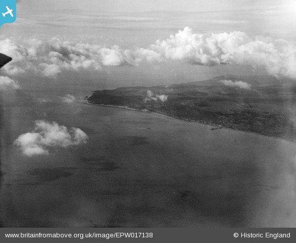
EPW017138 ENGLAND (1926). Beachy Head, Eastbourne, from the east, 1926
© Copyright OpenStreetMap contributors and licensed by the OpenStreetMap Foundation. 2026. Cartography is licensed as CC BY-SA.
Details
| Title | [EPW017138] Beachy Head, Eastbourne, from the east, 1926 |
| Reference | EPW017138 |
| Date | October-1926 |
| Link | |
| Place name | EASTBOURNE |
| Parish | |
| District | |
| Country | ENGLAND |
| Easting / Northing | 561780, 97750 |
| Longitude / Latitude | 0.29389970799044, 50.756198338046 |
| National Grid Reference | TV618978 |
Pins

bescotbeast |
Saturday 1st of March 2014 01:15:54 AM | |

Alan McFaden |
Wednesday 20th of November 2013 11:16:34 PM |


![[EPW017138] Beachy Head, Eastbourne, from the east, 1926](http://britainfromabove.org.uk/sites/all/libraries/aerofilms-images/public/100x100/EPW/017/EPW017138.jpg)
![[EPW017137] Beachy Head, Eastbourne, from the east, 1926](http://britainfromabove.org.uk/sites/all/libraries/aerofilms-images/public/100x100/EPW/017/EPW017137.jpg)
![[EPW000084] The junction of Victoria Place and the Grand Parade, Eastbourne, 1920](http://britainfromabove.org.uk/sites/all/libraries/aerofilms-images/public/100x100/EPW/000/EPW000084.jpg)
