
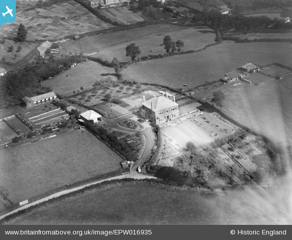
EPW016935 ENGLAND (1926). House and gardens off Courtney Road, Kingswood, 1926
© Copyright OpenStreetMap contributors and licensed by the OpenStreetMap Foundation. 2026. Cartography is licensed as CC BY-SA.
Nearby Images (3)
EPW016935

EPW016933

EPW016934

Details
| Title | [EPW016935] House and gardens off Courtney Road, Kingswood, 1926 |
| Reference | EPW016935 |
| Date | 13-September-1926 |
| Link | |
| Place name | KINGSWOOD |
| Parish | |
| District | |
| Country | ENGLAND |
| Easting / Northing | 365333, 173328 |
| Longitude / Latitude | -2.4990168404408, 51.45737903725 |
| National Grid Reference | ST653733 |
Pins

Past Forward |
Thursday 25th of June 2026 12:09:38 PM | |
|
tony way |
Thursday 26th of December 2013 08:05:42 PM | |
|
tony way |
Thursday 26th of December 2013 08:04:16 PM | |
|
tony way |
Sunday 18th of August 2013 12:17:14 PM | |
|
James Chandler |
Friday 4th of January 2013 07:46:25 PM | |
Not on map from early 20th.century, so built between say 1905 and 1926. Still on aerial photo from 1946. |
knightley |
Thursday 23rd of May 2013 09:53:24 PM |
there is a building on the same spot in 1903 so may have been demloished for woodstock house on this picture |
tony way |
Thursday 26th of December 2013 08:10:59 PM |
the home of john douglas i beleive |
tony way |
Tuesday 28th of January 2014 11:09:58 PM |

Class31 |
Wednesday 11th of July 2012 08:43:51 PM | |
|
Class31 |
Wednesday 11th of July 2012 08:42:44 PM | |
|
Class31 |
Wednesday 11th of July 2012 08:42:19 PM |
User Comment Contributions

owner of woodstock as detailed |
tony way |
Tuesday 28th of January 2014 11:47:39 PM |
click on black rectangle on above post to reveal |
tony way |
Tuesday 28th of January 2014 11:47:39 PM |
The main house in the picture is believed demolished. |
Class31 |
Thursday 23rd of May 2013 09:53:51 PM |
Definitely demolished. |
knightley |
Thursday 23rd of May 2013 09:53:51 PM |