
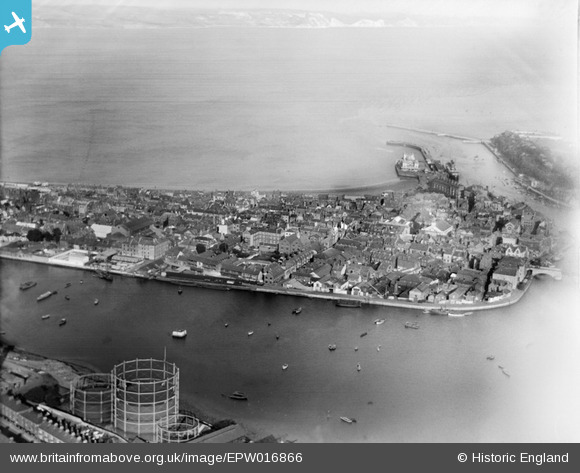
EPW016866 ENGLAND (1926). The Backwater, town and harbour, Weymouth, from the west, 1926
© Copyright OpenStreetMap contributors and licensed by the OpenStreetMap Foundation. 2026. Cartography is licensed as CC BY-SA.
Nearby Images (7)
EPW016866

EPW039704

EAW002988

EPW013533

EPW013603

EPW013604

EPW039705

Details
| Title | [EPW016866] The Backwater, town and harbour, Weymouth, from the west, 1926 |
| Reference | EPW016866 |
| Date | August-1926 |
| Link | |
| Place name | WEYMOUTH |
| Parish | |
| District | |
| Country | ENGLAND |
| Easting / Northing | 367770, 78923 |
| Longitude / Latitude | -2.4555382697084, 50.608544913247 |
| National Grid Reference | SY678789 |
Pins
User Comment Contributions

St. Mary's Church, Weymouth, 30/05/2014 |

Class31 |
Saturday 31st of May 2014 08:01:35 PM |