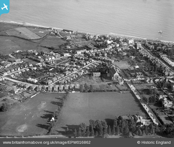
EPW016862 ENGLAND (1926). St John's Church and the sea, Sandown, 1926
© Copyright OpenStreetMap contributors and licensed by the OpenStreetMap Foundation. 2026. Cartography is licensed as CC BY-SA.
Details
| Title | [EPW016862] St John's Church and the sea, Sandown, 1926 |
| Reference | EPW016862 |
| Date | August-1926 |
| Link | |
| Place name | SANDOWN |
| Parish | SANDOWN |
| District | |
| Country | ENGLAND |
| Easting / Northing | 460031, 84655 |
| Longitude / Latitude | -1.1506297419451, 50.657893123035 |
| National Grid Reference | SZ600847 |
Pins

Alan |
Friday 10th of July 2020 10:57:08 AM | |

HALLY64 |
Thursday 8th of August 2013 04:22:51 PM | |

Ian |
Thursday 1st of August 2013 12:49:55 PM | |

Ian |
Thursday 1st of August 2013 12:48:53 PM | |

Ian |
Thursday 1st of August 2013 12:43:39 PM |


![[EPW016862] St John's Church and the sea, Sandown, 1926](http://britainfromabove.org.uk/sites/all/libraries/aerofilms-images/public/100x100/EPW/016/EPW016862.jpg)
![[EAW038578] Sandown Bay and the town, Sandown, from the north, 1951. This image has been produced from a print.](http://britainfromabove.org.uk/sites/all/libraries/aerofilms-images/public/100x100/EAW/038/EAW038578.jpg)
![[EPW023082] The junction of Victoria Road, High Street and Avenue Slipway, Sandown, 1928](http://britainfromabove.org.uk/sites/all/libraries/aerofilms-images/public/100x100/EPW/023/EPW023082.jpg)