
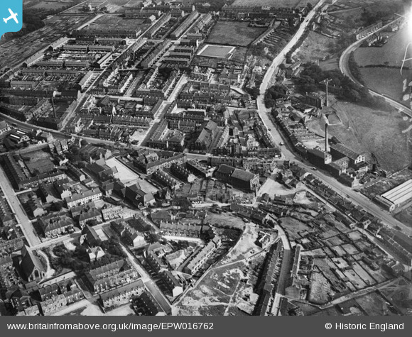
EPW016762 ENGLAND (1926). The Congregational Church and environs, Moldgreen, 1926
© Copyright OpenStreetMap contributors and licensed by the OpenStreetMap Foundation. 2026. Cartography is licensed as CC BY-SA.
Nearby Images (3)
EPW016762

EPW016761

EPW016763

Details
| Title | [EPW016762] The Congregational Church and environs, Moldgreen, 1926 |
| Reference | EPW016762 |
| Date | August-1926 |
| Link | |
| Place name | MOLDGREEN |
| Parish | |
| District | |
| Country | ENGLAND |
| Easting / Northing | 415736, 416389 |
| Longitude / Latitude | -1.7619430222555, 53.643541866472 |
| National Grid Reference | SE157164 |
Pins
Be the first to add a comment to this image!