
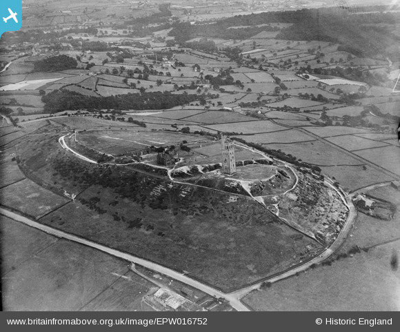
EPW016752 ENGLAND (1926). Castle Hill, Huddersfield, 1926
© Copyright OpenStreetMap contributors and licensed by the OpenStreetMap Foundation. 2026. Cartography is licensed as CC BY-SA.
Nearby Images (3)
EPW016752

EPW016753

EPW016751

Details
| Title | [EPW016752] Castle Hill, Huddersfield, 1926 |
| Reference | EPW016752 |
| Date | August-1926 |
| Link | |
| Place name | HUDDERSFIELD |
| Parish | |
| District | |
| Country | ENGLAND |
| Easting / Northing | 415232, 414032 |
| Longitude / Latitude | -1.7696829713256, 53.622369266012 |
| National Grid Reference | SE152140 |
Pins

RoyPlum |
Monday 30th of November 2020 03:40:04 PM | |
|
RoyPlum |
Monday 30th of November 2020 03:35:15 PM | |
|
RoyPlum |
Monday 30th of November 2020 03:32:14 PM | |
|
RoyPlum |
Monday 30th of November 2020 03:31:01 PM | |
|
RoyPlum |
Monday 30th of November 2020 03:29:24 PM | |
|
RoyPlum |
Monday 30th of November 2020 03:28:24 PM | |
|
RoyPlum |
Monday 30th of November 2020 03:27:58 PM | |
|
RoyPlum |
Monday 30th of November 2020 03:26:16 PM | |
|
RoyPlum |
Monday 30th of November 2020 03:23:56 PM | |
|
RoyPlum |
Monday 30th of November 2020 03:20:16 PM | |
|
RoyPlum |
Monday 30th of November 2020 03:16:50 PM |


User Comment Contributions
The area with the house on the right of the picture is called Ogley, the house had a barn attached to it and was used as a Dye house for dyeing wool from the handloom weavers. |
Rover45 |
Saturday 30th of June 2012 06:02:57 PM |