
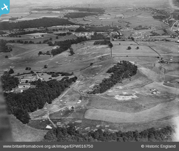
EPW016750 ENGLAND (1926). Fixby Golf Course, Huddersfield, from the west, 1926
© Copyright OpenStreetMap contributors and licensed by the OpenStreetMap Foundation. 2026. Cartography is licensed as CC BY-SA.
Nearby Images (4)
EPW016750

 0°
0m
EPW016748
 227°
176m
EPW016749
 30°
193m
EPW016746
 19°
215m
Details
| Title | [EPW016750] Fixby Golf Course, Huddersfield, from the west, 1926 |
| Reference | EPW016750 |
| Date | August-1926 |
| Link | |
| Place name | HUDDERSFIELD |
| Parish | |
| District | |
| Country | ENGLAND |
| Easting / Northing | 413160, 419286 |
| Longitude / Latitude | -1.8007901821217, 53.669654637091 |
| National Grid Reference | SE132193 |
Pins
 Ochre Hole - a stream running from the golf course |

Stan |
Monday 9th of November 2026 12:49:06 PM |
| Cowcliffe Hill Road. |
RT |
Sunday 13th of March 2022 04:18:49 PM |
| 255 Cowcliffe Hill Road. |
RT |
Sunday 13th of March 2022 04:17:56 PM |
| Netheroyd Hill Road. |
RT |
Sunday 13th of March 2022 04:12:22 PM |
| Lightridge Road |
RT |
Sunday 13th of March 2022 04:11:28 PM |
| Cowcliffe Hill Road. |
RT |
Sunday 13th of March 2022 04:10:58 PM |
| Broomfield Road. |
RT |
Sunday 13th of March 2022 04:09:11 PM |
| Craven House, Lightridge Road. |
RT |
Sunday 13th of March 2022 04:07:16 PM |
| Lightridge Road. |
RT |
Sunday 13th of March 2022 04:00:26 PM |
| 28 Lightridge Road. |
RT |
Sunday 13th of March 2022 03:59:44 PM |
| 26 Lightridge Road. |
RT |
Sunday 13th of March 2022 03:59:25 PM |