
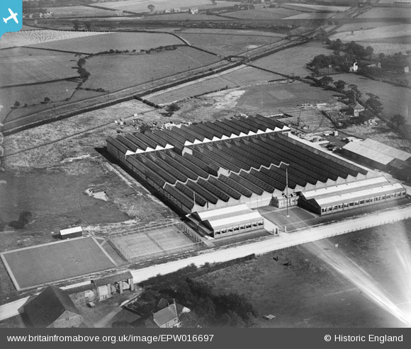
EPW016697 ENGLAND (1926). The Henry Simon Engineering Works, Cheadle Heath, 1926
© Copyright OpenStreetMap contributors and licensed by the OpenStreetMap Foundation. 2026. Cartography is licensed as CC BY-SA.
Nearby Images (8)
EPW016697

EPW016696

EPW016121

EPW016695

EPW016698

EPW016699

EPW016472

EPW016701

Details
| Title | [EPW016697] The Henry Simon Engineering Works, Cheadle Heath, 1926 |
| Reference | EPW016697 |
| Date | August-1926 |
| Link | |
| Place name | CHEADLE HEATH |
| Parish | |
| District | |
| Country | ENGLAND |
| Easting / Northing | 387944, 388373 |
| Longitude / Latitude | -2.1813072895306, 53.391792873761 |
| National Grid Reference | SJ879884 |
Pins

John Ellis |
Wednesday 8th of August 2012 11:37:26 PM | |
|
John Ellis |
Wednesday 8th of August 2012 11:31:18 PM | |
|
John Ellis |
Wednesday 8th of August 2012 11:29:13 PM | |
|
John Ellis |
Wednesday 8th of August 2012 11:26:25 PM | |
|
John Ellis |
Wednesday 8th of August 2012 11:24:19 PM | |
|
John Ellis |
Wednesday 8th of August 2012 11:22:30 PM |