
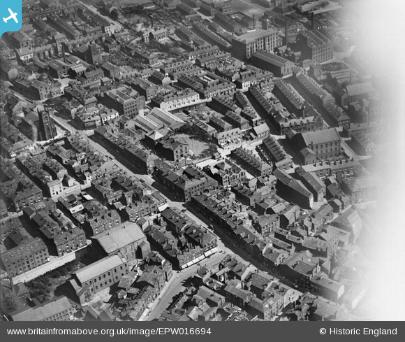
EPW016694 ENGLAND (1926). Yorkshire Street, Rochdale, 1926
© Copyright OpenStreetMap contributors and licensed by the OpenStreetMap Foundation. 2026. Cartography is licensed as CC BY-SA.
Nearby Images (2)
EPW016694

EPW016788

Details
| Title | [EPW016694] Yorkshire Street, Rochdale, 1926 |
| Reference | EPW016694 |
| Date | August-1926 |
| Link | |
| Place name | ROCHDALE |
| Parish | |
| District | |
| Country | ENGLAND |
| Easting / Northing | 389890, 413641 |
| Longitude / Latitude | -2.1528569798402, 53.618978431234 |
| National Grid Reference | SD899136 |
Pins

bobmunc |
Sunday 24th of March 2019 08:04:07 PM | |
|
Mikeya |
Monday 17th of September 2018 10:31:01 PM | |
|
Mikeya |
Monday 17th of September 2018 10:29:53 PM | |
|
Mikeya |
Monday 17th of September 2018 10:28:59 PM | |
|
Mikeya |
Monday 17th of September 2018 10:27:57 PM |