
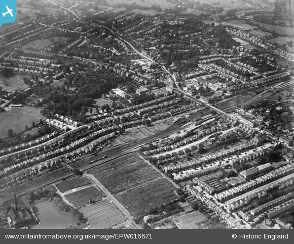
EPW016671 ENGLAND (1926). Regent's Park Road and Church End, Finchley, from the north-east, 1926
© Copyright OpenStreetMap contributors and licensed by the OpenStreetMap Foundation. 2026. Cartography is licensed as CC BY-SA.
Nearby Images (8)
EPW016671

EPW007402

EPW049730

EPW049734

EPW049731

EPW049732

EPW049735

EPW049733

Details
| Title | [EPW016671] Regent's Park Road and Church End, Finchley, from the north-east, 1926 |
| Reference | EPW016671 |
| Date | August-1926 |
| Link | |
| Place name | FINCHLEY |
| Parish | |
| District | |
| Country | ENGLAND |
| Easting / Northing | 525593, 190632 |
| Longitude / Latitude | -0.18641908172972, 51.600036394424 |
| National Grid Reference | TQ256906 |
Pins

Andy Mc |
Friday 4th of September 2015 09:35:52 PM | |
|
Harpie |
Thursday 26th of February 2015 05:04:11 PM | |
|
Harpie |
Thursday 26th of February 2015 04:59:05 PM | |
|
Harpie |
Thursday 26th of February 2015 04:57:38 PM | |
|
James Gardiner |
Monday 14th of July 2014 12:47:36 PM | |
|
mad |
Sunday 7th of July 2013 11:37:19 PM | |
|
mad |
Sunday 7th of July 2013 11:32:14 PM | |
|
snapper31 |
Wednesday 9th of January 2013 12:50:42 PM | |
|
snapper31 |
Wednesday 9th of January 2013 12:49:21 PM | |
|
snapper31 |
Wednesday 9th of January 2013 12:48:08 PM | |
|
snapper31 |
Wednesday 9th of January 2013 12:46:38 PM |