
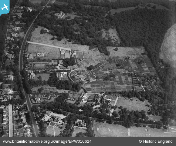
EPW016624 ENGLAND (1926). Coombewood Nursery and environs, Coombe, 1926
© Copyright OpenStreetMap contributors and licensed by the OpenStreetMap Foundation. 2025. Cartography is licensed as CC BY-SA.
Nearby Images (5)
EPW016624

EPW016634

EPW017324

EPW017322

EPW001679

Details
| Title | [EPW016624] Coombewood Nursery and environs, Coombe, 1926 |
| Reference | EPW016624 |
| Date | August-1926 |
| Link | |
| Place name | COOMBE |
| Parish | |
| District | |
| Country | ENGLAND |
| Easting / Northing | 520300, 171037 |
| Longitude / Latitude | -0.26950043165073, 51.425065017093 |
| National Grid Reference | TQ203710 |
Pins
Be the first to add a comment to this image!