
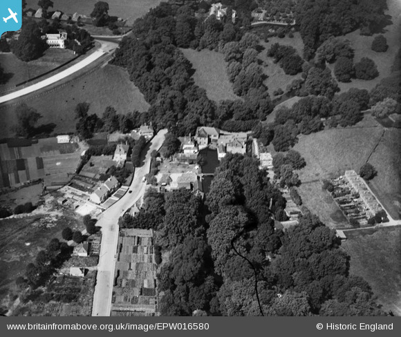
EPW016580 ENGLAND (1926). Ravensbury Mill area, Morden, 1926
© Copyright OpenStreetMap contributors and licensed by the OpenStreetMap Foundation. 2026. Cartography is licensed as CC BY-SA.
Nearby Images (5)
EPW016580

EPW016580
EPW031811

EPW016579

EPW016579
Details
| Title | [EPW016580] Ravensbury Mill area, Morden, 1926 |
| Reference | EPW016580 |
| Date | August-1926 |
| Link | |
| Place name | MORDEN |
| Parish | |
| District | |
| Country | ENGLAND |
| Easting / Northing | 526430, 168143 |
| Longitude / Latitude | -0.18239979055295, 51.397718868279 |
| National Grid Reference | TQ264681 |
Pins

Anne |
Sunday 10th of April 2016 01:34:16 PM | |
|
Anne |
Sunday 10th of April 2016 01:33:05 PM | |
|
Dave Smith |
Thursday 25th of February 2016 05:57:44 PM | |
|
Johnners |
Tuesday 4th of June 2013 12:44:19 PM | |
|
mordenman |
Thursday 20th of September 2012 02:53:20 PM | |
|
mordenman |
Thursday 20th of September 2012 02:52:00 PM | |
Paper never produced at Ravensbury Mill. Started life as a snuff mill and spend most of the 1900's as a sports goods and wood factory for Whitley Products. Whitley's moved to Daventry in 1990's and site sold to developers. Mill House was demolished and rest of site turned into apartments. |
Whitley Worker |
Tuesday 14th of January 2014 01:12:56 PM |
|
mordenman |
Thursday 20th of September 2012 02:45:45 PM | |
|
mordenman |
Thursday 20th of September 2012 02:43:25 PM | |
|
mordenman |
Thursday 20th of September 2012 02:42:59 PM |