
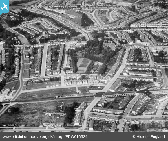
EPW016524 ENGLAND (1926). Highfield Avenue and environs, Golders Green, 1926
© Copyright OpenStreetMap contributors and licensed by the OpenStreetMap Foundation. 2026. Cartography is licensed as CC BY-SA.
Nearby Images (4)
EPW016524

EPW016525

EPW038803

EPW016526

Details
| Title | [EPW016524] Highfield Avenue and environs, Golders Green, 1926 |
| Reference | EPW016524 |
| Date | August-1926 |
| Link | |
| Place name | GOLDERS GREEN |
| Parish | |
| District | |
| Country | ENGLAND |
| Easting / Northing | 523993, 188084 |
| Longitude / Latitude | -0.21041140764033, 51.577489603421 |
| National Grid Reference | TQ240881 |
