
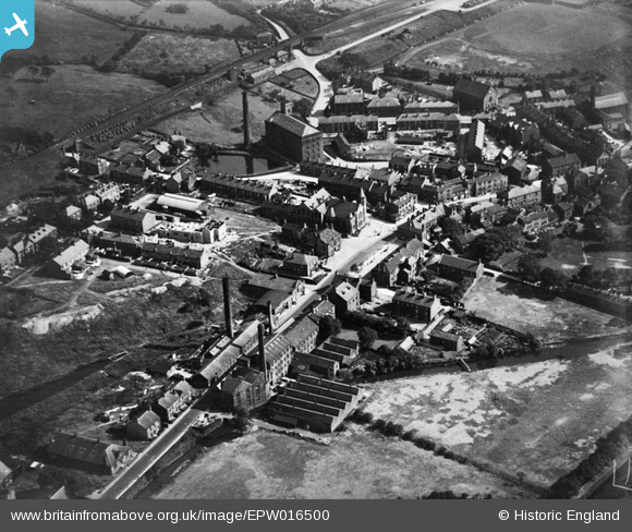
EPW016500 ENGLAND (1926). The Square and town centre, Uppermill, 1926
© Copyright OpenStreetMap contributors and licensed by the OpenStreetMap Foundation. 2026. Cartography is licensed as CC BY-SA.
Nearby Images (2)
EPW016500

EPW016501

Details
| Title | [EPW016500] The Square and town centre, Uppermill, 1926 |
| Reference | EPW016500 |
| Date | August-1926 |
| Link | |
| Place name | UPPERMILL |
| Parish | SADDLEWORTH |
| District | |
| Country | ENGLAND |
| Easting / Northing | 399774, 405855 |
| Longitude / Latitude | -2.0034113473341, 53.549085021854 |
| National Grid Reference | SD998059 |
Pins

jams39 |
Friday 26th of November 2021 11:40:51 AM | |
|
jams39 |
Friday 26th of November 2021 11:40:34 AM | |
|
stardelta |
Friday 26th of February 2016 10:28:18 AM | |
|
phirst |
Monday 22nd of October 2012 11:54:04 AM | |
|
David Beilby |
Friday 19th of October 2012 08:42:00 PM | |
Hi David, Your comments on this photo are really useful, thanks for helping to show what's in the image. You know the location well; I wonder if you would write a wiki entry for the image that explains the differences between then and now? Yours, Katy Britain from Above Cataloguing Team Leader |
Katy Whitaker |
Friday 19th of October 2012 08:50:37 PM |
|
David Beilby |
Friday 19th of October 2012 08:40:09 PM | |
This line was a relief track to avoid congestion on the still-existing main line. It separated from the main line at Diggle & rejoined at Stalybridge. |
TheBlueCube |
Monday 17th of November 2014 12:57:57 AM |
|
David Beilby |
Friday 19th of October 2012 08:38:20 PM | |
|
David Beilby |
Friday 19th of October 2012 08:15:09 PM |