
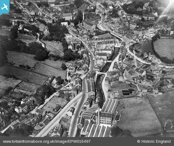
EPW016497 ENGLAND (1926). Upper Bridge and the town centre, Holmfirth, 1926
© Copyright OpenStreetMap contributors and licensed by the OpenStreetMap Foundation. 2026. Cartography is licensed as CC BY-SA.
Nearby Images (2)
EPW016497

EPW016499

Details
| Title | [EPW016497] Upper Bridge and the town centre, Holmfirth, 1926 |
| Reference | EPW016497 |
| Date | August-1926 |
| Link | |
| Place name | HOLMFIRTH |
| Parish | HOLME VALLEY |
| District | |
| Country | ENGLAND |
| Easting / Northing | 414068, 408122 |
| Longitude / Latitude | -1.7875499037004, 53.569275337842 |
| National Grid Reference | SE141081 |
Pins

Blayeman |
Wednesday 12th of November 2014 11:49:54 AM | |
|
Blayeman |
Wednesday 12th of November 2014 11:48:05 AM | |
|
Blayeman |
Wednesday 12th of November 2014 11:47:07 AM | |
|
Blayeman |
Wednesday 12th of November 2014 11:46:21 AM | |
|
Blayeman |
Wednesday 12th of November 2014 11:45:42 AM |