
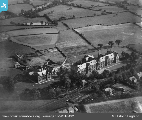
EPW016492 ENGLAND (1926). The Manchester Warehouseman and Clerks' Orphan School, Cheadle Hulme, 1926
© Copyright OpenStreetMap contributors and licensed by the OpenStreetMap Foundation. 2026. Cartography is licensed as CC BY-SA.
Nearby Images (2)
EPW016492

EPW016493

Details
| Title | [EPW016492] The Manchester Warehouseman and Clerks' Orphan School, Cheadle Hulme, 1926 |
| Reference | EPW016492 |
| Date | August-1926 |
| Link | |
| Place name | CHEADLE HULME |
| Parish | |
| District | |
| Country | ENGLAND |
| Easting / Northing | 387110, 385692 |
| Longitude / Latitude | -2.1937401164804, 53.367672075362 |
| National Grid Reference | SJ871857 |
Pins

Tonyharl |
Tuesday 24th of December 2019 01:48:45 PM | |
|
Tonyharl |
Tuesday 24th of December 2019 01:47:17 PM | |
|
Tonyharl |
Tuesday 24th of December 2019 01:45:39 PM | |
|
Tonyharl |
Tuesday 24th of December 2019 01:44:57 PM | |
|
John Ellis |
Thursday 1st of September 2016 09:34:51 PM | |
|
John Ellis |
Thursday 1st of September 2016 09:34:11 PM | |
|
John Ellis |
Thursday 1st of September 2016 09:33:10 PM | |
|
John Ellis |
Thursday 1st of September 2016 09:32:29 PM |