
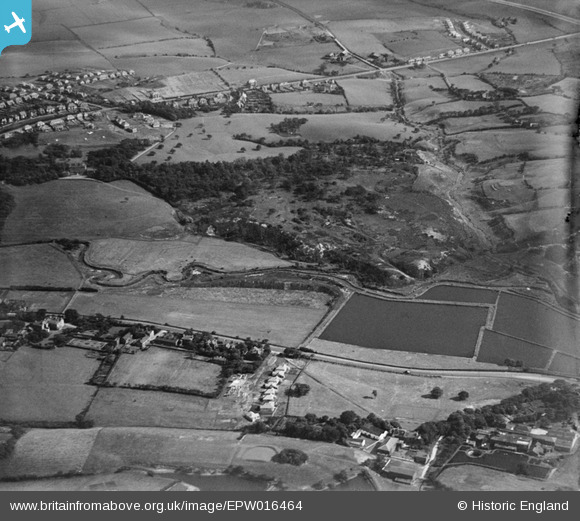
EPW016464 ENGLAND (1926). Alkrington Wood, Middleton, 1926
© Copyright OpenStreetMap contributors and licensed by the OpenStreetMap Foundation. 2026. Cartography is licensed as CC BY-SA.
Nearby Images (2)
EPW016464

EPW016463

Details
| Title | [EPW016464] Alkrington Wood, Middleton, 1926 |
| Reference | EPW016464 |
| Date | 6-August-1926 |
| Link | |
| Place name | MIDDLETON |
| Parish | |
| District | |
| Country | ENGLAND |
| Easting / Northing | 386162, 405195 |
| Longitude / Latitude | -2.2088471290314, 53.542969724081 |
| National Grid Reference | SD862052 |
Pins

Dam8888 |
Thursday 4th of February 2021 11:12:00 PM | |
|
padraig |
Sunday 29th of March 2020 02:01:32 PM | |
|
chris0241 |
Thursday 21st of August 2014 12:10:38 AM | |
|
chris0241 |
Thursday 21st of August 2014 12:09:52 AM | |
|
Moonraker2 |
Thursday 16th of August 2012 11:23:27 PM | |
|
Al Roach |
Tuesday 17th of July 2012 08:34:33 PM | |
|
Al Roach |
Tuesday 17th of July 2012 08:32:26 PM | |
|
Al Roach |
Tuesday 17th of July 2012 08:29:07 PM | |
|
Al Roach |
Tuesday 17th of July 2012 08:27:05 PM | |
|
Al Roach |
Tuesday 17th of July 2012 08:24:47 PM | |
|
John Clift |
Monday 2nd of July 2012 01:55:40 PM |