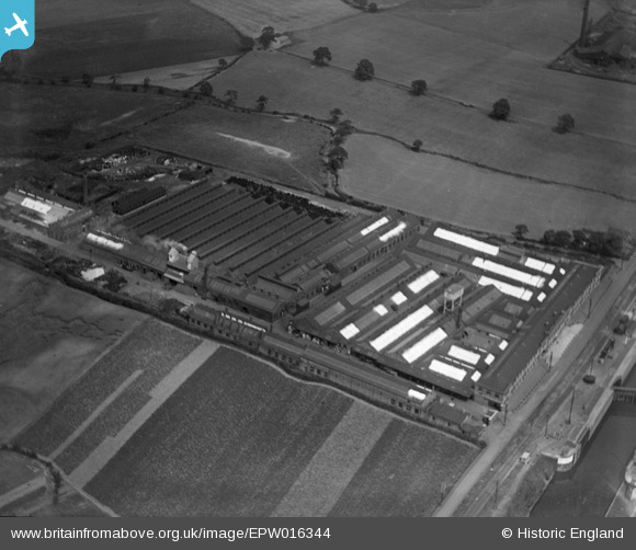
EPW016344 ENGLAND (1926). The Richmond Gas Stove and Meter Works, Warrington, 1926
© Copyright OpenStreetMap contributors and licensed by the OpenStreetMap Foundation. 2026. Cartography is licensed as CC BY-SA.
Nearby Images (8)
Details
| Title | [EPW016344] The Richmond Gas Stove and Meter Works, Warrington, 1926 |
| Reference | EPW016344 |
| Date | July-1926 |
| Link | |
| Place name | WARRINGTON |
| Parish | |
| District | |
| Country | ENGLAND |
| Easting / Northing | 363632, 387458 |
| Longitude / Latitude | -2.5468120498517, 53.382452820821 |
| National Grid Reference | SJ636875 |
Pins

Bottom Yard |
Sunday 13th of January 2019 03:56:51 PM | |

Bottom Yard |
Sunday 13th of January 2019 03:55:11 PM | |

Bottom Yard |
Sunday 13th of January 2019 03:38:22 PM | |

Bottom Yard |
Sunday 13th of January 2019 03:36:10 PM | |

Bottom Yard |
Sunday 13th of January 2019 03:31:54 PM | |

Bottom Yard |
Sunday 13th of January 2019 03:27:30 PM |


![[EPW016344] The Richmond Gas Stove and Meter Works, Warrington, 1926](http://britainfromabove.org.uk/sites/all/libraries/aerofilms-images/public/100x100/EPW/016/EPW016344.jpg)
![[EPW016344A] The Richmond Gas Stove and Meter Works, Warrington, 1926](http://britainfromabove.org.uk/sites/all/libraries/aerofilms-images/public/100x100/EPW/016/EPW016344A.jpg)
![[EPW027872] The Richmond Gas Works and Latchford Locks, Latchford, 1929](http://britainfromabove.org.uk/sites/all/libraries/aerofilms-images/public/100x100/EPW/027/EPW027872.jpg)
![[EPW027873] The Richmond Gas Works and Latchford Locks, Latchford, 1929](http://britainfromabove.org.uk/sites/all/libraries/aerofilms-images/public/100x100/EPW/027/EPW027873.jpg)
![[EPR000319] The Richmond Gas Stove Co Ltd Works by Latchford Locks, Warrington, 1934](http://britainfromabove.org.uk/sites/all/libraries/aerofilms-images/public/100x100/EPR/000/EPR000319.jpg)
![[EAW008433] Latchford Locks and sluices on the Manchester Ship Canal, Warrington, 1947](http://britainfromabove.org.uk/sites/all/libraries/aerofilms-images/public/100x100/EAW/008/EAW008433.jpg)
![[EAW008434] Latchford Locks and sluices on the Manchester Ship Canal, Warrington, 1947](http://britainfromabove.org.uk/sites/all/libraries/aerofilms-images/public/100x100/EAW/008/EAW008434.jpg)
![[EPR000292] The Richmond Gas Stove Co Works alongside Latchford Locks, Warrington, 1934](http://britainfromabove.org.uk/sites/all/libraries/aerofilms-images/public/100x100/EPR/000/EPR000292.jpg)