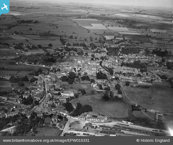
EPW016331 ENGLAND (1926). View of the town, Horncastle, from the west, 1926
© Copyright OpenStreetMap contributors and licensed by the OpenStreetMap Foundation. 2025. Cartography is licensed as CC BY-SA.
Details
| Title | [EPW016331] View of the town, Horncastle, from the west, 1926 |
| Reference | EPW016331 |
| Date | July-1926 |
| Link | |
| Place name | HORNCASTLE |
| Parish | HORNCASTLE |
| District | |
| Country | ENGLAND |
| Easting / Northing | 525493, 369491 |
| Longitude / Latitude | -0.12075964861115, 53.207367675922 |
| National Grid Reference | TF255695 |
Pins
 MB |
Wednesday 12th of October 2016 04:23:28 PM | |
 MB |
Wednesday 12th of October 2016 04:22:26 PM | |
 MB |
Wednesday 12th of October 2016 04:21:02 PM | |
 MB |
Wednesday 12th of October 2016 04:19:50 PM | |
 MB |
Wednesday 12th of October 2016 04:18:51 PM | |
 MB |
Wednesday 12th of October 2016 04:18:02 PM | |
 kent |
Wednesday 18th of July 2012 08:15:24 AM | |
 kent |
Wednesday 18th of July 2012 08:11:42 AM | |
 kent |
Wednesday 18th of July 2012 08:06:30 AM |


![[EPW016331] View of the town, Horncastle, from the west, 1926](http://britainfromabove.org.uk/sites/all/libraries/aerofilms-images/public/100x100/EPW/016/EPW016331.jpg)
![[EPW016330] View of the town, Horncastle, from the north-west, 1926](http://britainfromabove.org.uk/sites/all/libraries/aerofilms-images/public/100x100/EPW/016/EPW016330.jpg)