
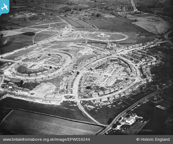
EPW016244 ENGLAND (1926). Houses under construction at Lupset, Wakefield, 1926. This image has been produced from a copy-negative.
© Copyright OpenStreetMap contributors and licensed by the OpenStreetMap Foundation. 2026. Cartography is licensed as CC BY-SA.
Nearby Images (2)
EPW016244

EPW032680

Details
| Title | [EPW016244] Houses under construction at Lupset, Wakefield, 1926. This image has been produced from a copy-negative. |
| Reference | EPW016244 |
| Date | 14-July-1926 |
| Link | |
| Place name | WAKEFIELD |
| Parish | |
| District | |
| Country | ENGLAND |
| Easting / Northing | 431142, 419557 |
| Longitude / Latitude | -1.5285672387992, 53.671328543322 |
| National Grid Reference | SE311196 |
Pins
Be the first to add a comment to this image!