
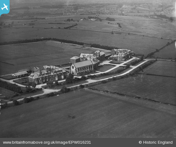
EPW016231 ENGLAND (1926). Queen Ethelburga's School, Harrogate, 1926
© Copyright OpenStreetMap contributors and licensed by the OpenStreetMap Foundation. 2026. Cartography is licensed as CC BY-SA.
Nearby Images (4)
EPW016231

EPW016230

EPW016229

EPW016228

Details
| Title | [EPW016231] Queen Ethelburga's School, Harrogate, 1926 |
| Reference | EPW016231 |
| Date | 14-July-1926 |
| Link | |
| Place name | HARROGATE |
| Parish | |
| District | |
| Country | ENGLAND |
| Easting / Northing | 427834, 455495 |
| Longitude / Latitude | -1.5753878846131, 53.994551639505 |
| National Grid Reference | SE278555 |
Pins
Be the first to add a comment to this image!