
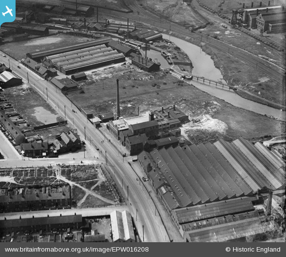
EPW016208 ENGLAND (1926). The British Abrasive Wheel Works and surrounding industry, Tinsley, 1926
© Copyright OpenStreetMap contributors and licensed by the OpenStreetMap Foundation. 2025. Cartography is licensed as CC BY-SA.
Nearby Images (4)
EPW016208

EPW016206

EPW016209

EPW016207

Details
| Title | [EPW016208] The British Abrasive Wheel Works and surrounding industry, Tinsley, 1926 |
| Reference | EPW016208 |
| Date | July-1926 |
| Link | |
| Place name | TINSLEY |
| Parish | |
| District | |
| Country | ENGLAND |
| Easting / Northing | 440173, 391382 |
| Longitude / Latitude | -1.3954813582229, 53.417450379428 |
| National Grid Reference | SK402914 |
Pins

RichardL |
Wednesday 6th of August 2014 06:12:41 PM | |
|
RichardL |
Wednesday 6th of August 2014 08:09:33 AM | |
|
RichardL |
Wednesday 6th of August 2014 08:05:31 AM | |
|
RichardL |
Wednesday 6th of August 2014 07:58:53 AM | |
|
RichardL |
Wednesday 6th of August 2014 07:55:54 AM | |
|
RichardL |
Wednesday 6th of August 2014 07:55:01 AM | |
|
RichardL |
Wednesday 6th of August 2014 07:54:18 AM | |
|
RichardL |
Wednesday 6th of August 2014 07:53:10 AM | |
|
MB |
Sunday 30th of September 2012 11:17:31 PM | |
|
MB |
Sunday 30th of September 2012 11:16:18 PM | |
|
MB |
Sunday 30th of September 2012 11:15:28 PM |