
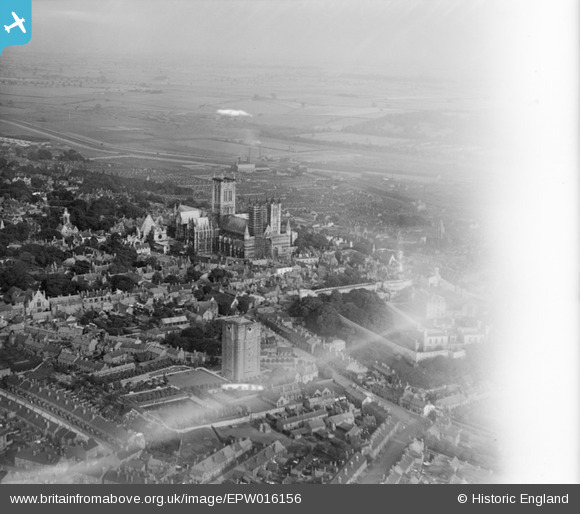
EPW016156 ENGLAND (1926). The town centre, Lincoln, from the north-west, 1926
© Copyright OpenStreetMap contributors and licensed by the OpenStreetMap Foundation. 2026. Cartography is licensed as CC BY-SA.
Nearby Images (13)
EPW016156

EPW041640

EPW041641

EAW015729

EAW005041

EAW005045

EAW005046

EAW023936

EAW015700

EAW003314

EAW015701

EAW015703

EPW041639

Details
| Title | [EPW016156] The town centre, Lincoln, from the north-west, 1926 |
| Reference | EPW016156 |
| Date | 2-July-1926 |
| Link | |
| Place name | LINCOLN |
| Parish | |
| District | |
| Country | ENGLAND |
| Easting / Northing | 497448, 372003 |
| Longitude / Latitude | -0.53979117235855, 53.235824828569 |
| National Grid Reference | SK974720 |
Pins

Lord Elpuss |
Friday 19th of October 2012 05:53:41 PM | |

Class31 |
Monday 1st of October 2012 08:54:47 AM | |
|
Class31 |
Monday 1st of October 2012 08:49:19 AM | |
|
Class31 |
Monday 1st of October 2012 08:47:43 AM | |
|
Class31 |
Monday 1st of October 2012 08:45:58 AM | |
|
Class31 |
Monday 1st of October 2012 08:44:28 AM | |
|
Class31 |
Monday 1st of October 2012 08:43:30 AM | |
Interesting to note in this picture the pale colour of the tower. Fifty years later, it was virtually black due to pollution. After cleaning a few years ago it now looks more or less as it did in 1926. |
Lord Elpuss |
Friday 19th of October 2012 05:52:21 PM |