
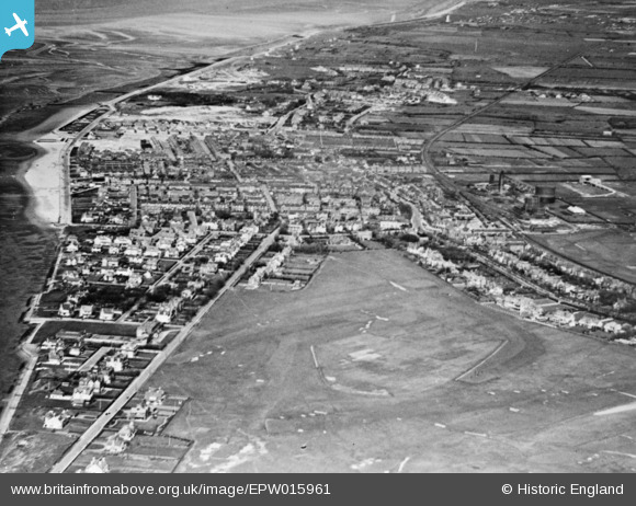
EPW015961 ENGLAND (1926). The Royal Liverpool Golf Club and the town, Hoylake, from the south-west, 1926. This image has been produced from a copy-negative.
© Copyright OpenStreetMap contributors and licensed by the OpenStreetMap Foundation. 2025. Cartography is licensed as CC BY-SA.
Nearby Images (2)
EPW015961

EPW013710

Details
| Title | [EPW015961] The Royal Liverpool Golf Club and the town, Hoylake, from the south-west, 1926. This image has been produced from a copy-negative. |
| Reference | EPW015961 |
| Date | June-1926 |
| Link | |
| Place name | HOYLAKE |
| Parish | |
| District | |
| Country | ENGLAND |
| Easting / Northing | 320987, 388538 |
| Longitude / Latitude | -3.1881619852236, 53.387501785311 |
| National Grid Reference | SJ210885 |
Pins
Be the first to add a comment to this image!