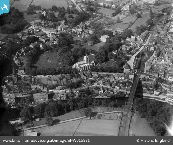
EPW015831 ENGLAND (1926). St John the Baptist Church and environs, Knaresborough, 1926
    © Copyright OpenStreetMap contributors and licensed by the OpenStreetMap Foundation. 2025. Cartography is licensed as CC BY-SA.
  
Nearby Images (8)
Details
| Title | [EPW015831] St John the Baptist Church and environs, Knaresborough, 1926 | 
| Reference | EPW015831 | 
| Date | 5-July-1926 | 
| Link | |
| Place name | KNARESBOROUGH | 
| Parish | KNARESBOROUGH | 
| District | |
| Country | ENGLAND | 
| Easting / Northing | 434699, 457177 | 
| Longitude / Latitude | -1.4704738066807, 54.009254441472 | 
| National Grid Reference | SE347572 | 
Pins
|  Knaresborough Goods Junction signalbox |   MattG | Sunday 4th of December 2016 10:36:00 PM | 
|  Mitre Hotel |   aoxomoxoa | Saturday 4th of October 2014 02:07:06 PM | 
|  Thatched Cottage |   aoxomoxoa | Saturday 4th of October 2014 02:04:45 PM | 
|  Claro Laundry |   aoxomoxoa | Saturday 4th of October 2014 02:02:54 PM | 
|  The World's End |   aoxomoxoa | Saturday 4th of October 2014 02:01:50 PM | 
|  Possible engine shed |   MB | Saturday 29th of September 2012 11:56:43 PM | 
| On another photo: 'Knaresborough Hospital', they are clearly coal drops. |   Philip | Saturday 6th of December 2014 05:41:59 AM | 
|  Railway Viaduct | Class31 | Monday 16th of July 2012 04:17:44 PM | 
|  Railway Station LNER | Class31 | Monday 16th of July 2012 04:15:21 PM | 
|  Knaresborough House | Class31 | Monday 16th of July 2012 04:14:49 PM | 
|  Waterside | Class31 | Monday 16th of July 2012 04:12:12 PM | 
|  The Parsonage | Class31 | Monday 16th of July 2012 04:11:55 PM | 
 
             
  ![[EPW015831] St John the Baptist Church and environs, Knaresborough, 1926](http://britainfromabove.org.uk/sites/all/libraries/aerofilms-images/public/100x100/EPW/015/EPW015831.jpg) 
  
                                          ![[EAW025644] The railway viaduct and part of the town, Knaresborough, 1949. This image has been produced from a print.](http://britainfromabove.org.uk/sites/all/libraries/aerofilms-images/public/100x100/EAW/025/EAW025644.jpg) 
 ![[EAW025642] The town, Knaresborough, from the north-west, 1949. This image has been produced from a print.](http://britainfromabove.org.uk/sites/all/libraries/aerofilms-images/public/100x100/EAW/025/EAW025642.jpg) 
 ![[EAW025641] The town, Knaresborough, from the north-west, 1949. This image has been produced from a print.](http://britainfromabove.org.uk/sites/all/libraries/aerofilms-images/public/100x100/EAW/025/EAW025641.jpg) 
 ![[EAW025647] The railway viaduct and town, Knaresborough, from the north-west, 1949. This image has been produced from a print.](http://britainfromabove.org.uk/sites/all/libraries/aerofilms-images/public/100x100/EAW/025/EAW025647.jpg) 
 ![[EAW025643] The town, Knaresborough, from the north-west, 1949. This image has been produced from a print.](http://britainfromabove.org.uk/sites/all/libraries/aerofilms-images/public/100x100/EAW/025/EAW025643.jpg) 
 ![[EPW015827] Knaresborough Castle and the town centre, Knaresborough, 1926](http://britainfromabove.org.uk/sites/all/libraries/aerofilms-images/public/100x100/EPW/015/EPW015827.jpg) 
 ![[EPW015830] Knaresborough Castle and the town centre, Knaresborough, 1926](http://britainfromabove.org.uk/sites/all/libraries/aerofilms-images/public/100x100/EPW/015/EPW015830.jpg)