
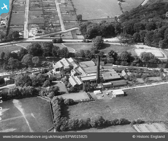
EPW015825 ENGLAND (1926). Wharfeside Paper Mill, Otley, 1926
© Copyright OpenStreetMap contributors and licensed by the OpenStreetMap Foundation. 2025. Cartography is licensed as CC BY-SA.
Nearby Images (8)
EPW015825

EPW015826

EPW015823

EPW015821

EPW015824

EPW015822

EPW015820

EPW015809

Details
| Title | [EPW015825] Wharfeside Paper Mill, Otley, 1926 |
| Reference | EPW015825 |
| Date | 5-June-1926 |
| Link | |
| Place name | OTLEY |
| Parish | OTLEY |
| District | |
| Country | ENGLAND |
| Easting / Northing | 420439, 446087 |
| Longitude / Latitude | -1.6888278290536, 53.910332006005 |
| National Grid Reference | SE204461 |
Pins
Be the first to add a comment to this image!