
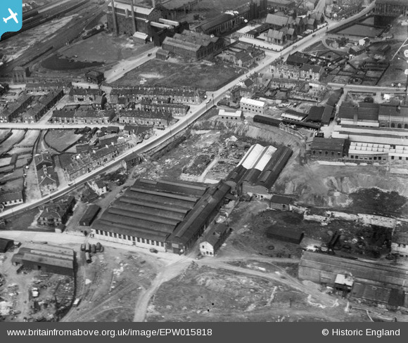
EPW015818 ENGLAND (1926). The Bowling Iron Works, Bradford, 1926
© Copyright OpenStreetMap contributors and licensed by the OpenStreetMap Foundation. 2025. Cartography is licensed as CC BY-SA.
Nearby Images (6)
EPW015818

EPW015813

EPW015815

EPW015814

EPW015819

EPW015816

Details
| Title | [EPW015818] The Bowling Iron Works, Bradford, 1926 |
| Reference | EPW015818 |
| Date | 4-June-1926 |
| Link | |
| Place name | BRADFORD |
| Parish | |
| District | |
| Country | ENGLAND |
| Easting / Northing | 418009, 432255 |
| Longitude / Latitude | -1.726633972371, 53.786088606635 |
| National Grid Reference | SE180323 |
