
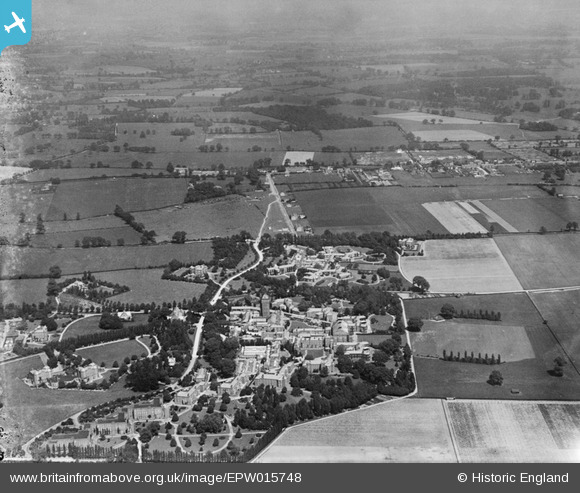
EPW015748 ENGLAND (1926). The Middlesex County Mental Hospital, Napsbury, from the west, 1926
© Copyright OpenStreetMap contributors and licensed by the OpenStreetMap Foundation. 2026. Cartography is licensed as CC BY-SA.
Nearby Images (5)
EPW015748

EPW025391

EPW015747

EPW025392

EPW024299

Details
| Title | [EPW015748] The Middlesex County Mental Hospital, Napsbury, from the west, 1926 |
| Reference | EPW015748 |
| Date | 7-June-1926 |
| Link | |
| Place name | NAPSBURY |
| Parish | LONDON COLNEY |
| District | |
| Country | ENGLAND |
| Easting / Northing | 516909, 204024 |
| Longitude / Latitude | -0.3072758827919, 51.722278158049 |
| National Grid Reference | TL169040 |
Pins

John W |
Monday 13th of June 2016 05:08:23 PM | |
|
John W |
Monday 13th of June 2016 05:07:50 PM | |
|
John W |
Monday 13th of June 2016 05:06:51 PM | |
|
John W |
Monday 13th of June 2016 05:05:57 PM | |
|
John W |
Monday 13th of June 2016 05:04:48 PM |