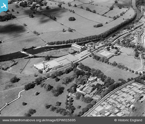
EPW015695 ENGLAND (1926). The Otley Worsted Mills, Otley, 1926
© Copyright OpenStreetMap contributors and licensed by the OpenStreetMap Foundation. 2024. Cartography is licensed as CC BY-SA.
Nearby Images (5)
Details
| Title | [EPW015695] The Otley Worsted Mills, Otley, 1926 |
| Reference | EPW015695 |
| Date | 31-May-1926 |
| Link | |
| Place name | OTLEY |
| Parish | OTLEY |
| District | |
| Country | ENGLAND |
| Easting / Northing | 419301, 445213 |
| Longitude / Latitude | -1.7062081070306, 53.902519498277 |
| National Grid Reference | SE193452 |
Pins
 MB |
Saturday 29th of September 2012 02:46:13 PM | |
 MB |
Saturday 29th of September 2012 02:45:20 PM | |
 MB |
Saturday 29th of September 2012 02:45:00 PM | |
 MB |
Saturday 29th of September 2012 02:42:11 PM | |
 MB |
Saturday 29th of September 2012 02:41:21 PM | |
 MB |
Saturday 29th of September 2012 02:38:25 PM | |
 MB |
Saturday 29th of September 2012 02:38:05 PM |


![[EPW015695] The Otley Worsted Mills, Otley, 1926](http://britainfromabove.org.uk/sites/all/libraries/aerofilms-images/public/100x100/EPW/015/EPW015695.jpg)
![[EPW015693] The Otley Worsted Mills, Otley, 1926](http://britainfromabove.org.uk/sites/all/libraries/aerofilms-images/public/100x100/EPW/015/EPW015693.jpg)
![[EPW015694] The Otley Worsted Mills, Otley, 1926](http://britainfromabove.org.uk/sites/all/libraries/aerofilms-images/public/100x100/EPW/015/EPW015694.jpg)
![[EPW015691] The Otley Worsted Mills, Otley, 1926](http://britainfromabove.org.uk/sites/all/libraries/aerofilms-images/public/100x100/EPW/015/EPW015691.jpg)
![[EPW015692] The Otley Worsted Mills, Otley, 1926](http://britainfromabove.org.uk/sites/all/libraries/aerofilms-images/public/100x100/EPW/015/EPW015692.jpg)