
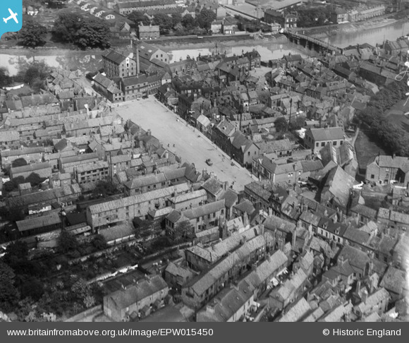
EPW015450 ENGLAND (1926). Micklegate, Selby, 1926
© Copyright OpenStreetMap contributors and licensed by the OpenStreetMap Foundation. 2026. Cartography is licensed as CC BY-SA.
Nearby Images (14)
EPW015450

EAW043302

EAW043301

EPW015451

EPW040263

EPW015455

EAW015504

EPW015453

EPW015454

EPW040264

EAW015735

EPW015448

EPW015452

EAW015505

Details
| Title | [EPW015450] Micklegate, Selby, 1926 |
| Reference | EPW015450 |
| Date | 4-May-1926 |
| Link | |
| Place name | SELBY |
| Parish | SELBY |
| District | |
| Country | ENGLAND |
| Easting / Northing | 461497, 432494 |
| Longitude / Latitude | -1.0665263873879, 53.78491526744 |
| National Grid Reference | SE615325 |
Pins

chaz |
Saturday 23rd of February 2013 09:09:16 PM | |
Would these bungalows be Olympia Cottages |
Jill |
Sunday 17th of March 2013 03:37:15 PM |
|
chaz |
Tuesday 8th of January 2013 10:39:00 PM | |
|
chaz |
Tuesday 8th of January 2013 10:36:53 PM | |

Class31 |
Friday 26th of October 2012 10:25:50 AM | |
|
Class31 |
Friday 26th of October 2012 10:24:39 AM | |
|
Class31 |
Friday 26th of October 2012 10:23:37 AM | |
|
Class31 |
Friday 26th of October 2012 10:22:53 AM | |
|
Class31 |
Friday 26th of October 2012 10:22:04 AM | |
|
Class31 |
Friday 26th of October 2012 10:21:44 AM | |
|
Class31 |
Friday 26th of October 2012 10:21:26 AM |
User Comment Contributions
My mother was living in Micklegate, also known as Wide street,in the newsagents (Atkinsons) which was on the right of the square near the top. She would have been aged 14. |
chaz |
Monday 2nd of July 2012 09:30:01 PM |