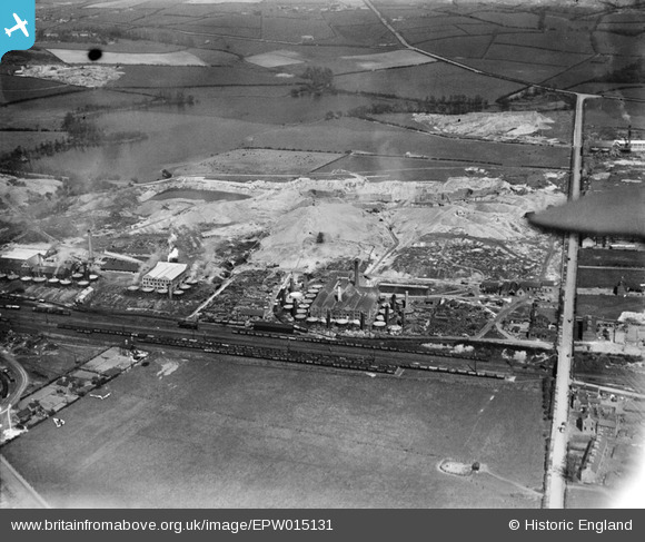
EPW015131 ENGLAND (1926). The Union Works, Moira, 1926
© Copyright OpenStreetMap contributors and licensed by the OpenStreetMap Foundation. 2026. Cartography is licensed as CC BY-SA.
Nearby Images (9)
Details
| Title | [EPW015131] The Union Works, Moira, 1926 |
| Reference | EPW015131 |
| Date | 13-April-1926 |
| Link | |
| Place name | MOIRA |
| Parish | ASHBY WOULDS |
| District | |
| Country | ENGLAND |
| Easting / Northing | 430372, 316518 |
| Longitude / Latitude | -1.5500329241673, 52.745092478845 |
| National Grid Reference | SK304165 |
Pins
Be the first to add a comment to this image!


![[EPW015131] The Union Works, Moira, 1926](http://britainfromabove.org.uk/sites/all/libraries/aerofilms-images/public/100x100/EPW/015/EPW015131.jpg)
![[EPW015130] The Donnington and Union Works, Moira, 1926](http://britainfromabove.org.uk/sites/all/libraries/aerofilms-images/public/100x100/EPW/015/EPW015130.jpg)
![[EPW015134] The Donnington and Union Works, Moira, 1926](http://britainfromabove.org.uk/sites/all/libraries/aerofilms-images/public/100x100/EPW/015/EPW015134.jpg)
![[EPW015126] The Union Pottery, Donnington Works and Reservoir Colliery, Moira, 1926](http://britainfromabove.org.uk/sites/all/libraries/aerofilms-images/public/100x100/EPW/015/EPW015126.jpg)
![[EPW015133] The Donnington and Union Works, Moira, 1926](http://britainfromabove.org.uk/sites/all/libraries/aerofilms-images/public/100x100/EPW/015/EPW015133.jpg)
![[EPW015124] The Union Pottery, Donnington Works and Reservoir Colliery, Moira, 1926](http://britainfromabove.org.uk/sites/all/libraries/aerofilms-images/public/100x100/EPW/015/EPW015124.jpg)
![[EPW015132] The Donnington and Union Works, Moira, 1926](http://britainfromabove.org.uk/sites/all/libraries/aerofilms-images/public/100x100/EPW/015/EPW015132.jpg)
![[EPW009446] The Donington Works, Moira, 1923](http://britainfromabove.org.uk/sites/all/libraries/aerofilms-images/public/100x100/EPW/009/EPW009446.jpg)
![[EPW009442] The Donington Works, Moira, 1923](http://britainfromabove.org.uk/sites/all/libraries/aerofilms-images/public/100x100/EPW/009/EPW009442.jpg)