
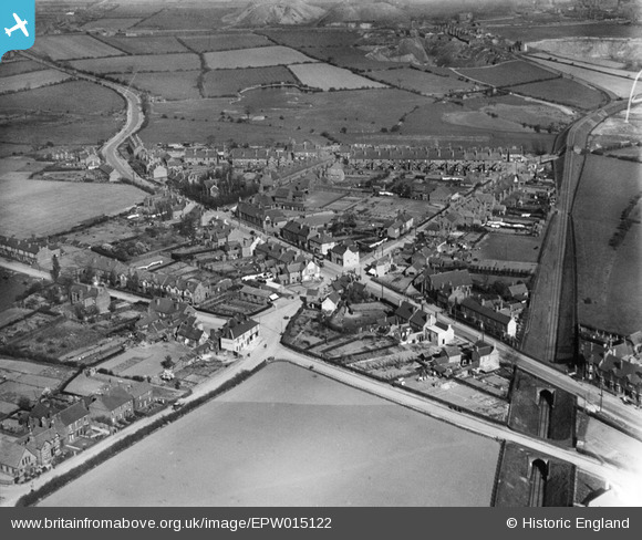
EPW015122 ENGLAND (1926). Walsall Road and environs, Shelfield, 1926
© Copyright OpenStreetMap contributors and licensed by the OpenStreetMap Foundation. 2026. Cartography is licensed as CC BY-SA.
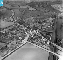
Nearby Images (2)
EPW015122

EPW015123

Details
| Title | [EPW015122] Walsall Road and environs, Shelfield, 1926 |
| Reference | EPW015122 |
| Date | 12-April-1926 |
| Link | |
| Place name | SHELFIELD |
| Parish | |
| District | |
| Country | ENGLAND |
| Easting / Northing | 403519, 302240 |
| Longitude / Latitude | -1.948017097725, 52.617565305179 |
| National Grid Reference | SK035022 |
Pins

Class31 |
Tuesday 1st of April 2014 08:44:16 PM | |
|
Class31 |
Tuesday 1st of April 2014 08:36:56 PM | |
|
Class31 |
Tuesday 1st of April 2014 08:35:11 PM | |
|
Class31 |
Tuesday 1st of April 2014 08:34:21 PM | |
|
Class31 |
Tuesday 1st of April 2014 08:33:07 PM | |
|
Class31 |
Tuesday 1st of April 2014 08:31:05 PM | |
|
Class31 |
Tuesday 1st of April 2014 08:28:49 PM | |

Martin |
Thursday 2nd of January 2014 06:58:54 PM | |
|
Martin |
Thursday 2nd of January 2014 06:57:34 PM | |
|
Tony |
Wednesday 28th of August 2013 09:56:28 PM | |
|
Tony |
Wednesday 28th of August 2013 09:55:21 PM | |
|
Tony |
Wednesday 28th of August 2013 09:52:45 PM |
User Comment Contributions
Shelfield, Lichfield Road, looking towards Aldridge in the distance. |

Barry Carpenter |
Tuesday 26th of June 2012 04:21:22 PM |