
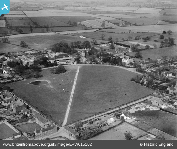
EPW015102 ENGLAND (1926). The Croft and St Mary's Church, Aldridge, from the south-west, 1926
© Copyright OpenStreetMap contributors and licensed by the OpenStreetMap Foundation. 2026. Cartography is licensed as CC BY-SA.
Nearby Images (2)
EPW015102

EPW015104

Details
| Title | [EPW015102] The Croft and St Mary's Church, Aldridge, from the south-west, 1926 |
| Reference | EPW015102 |
| Date | 12-April-1926 |
| Link | |
| Place name | ALDRIDGE |
| Parish | |
| District | |
| Country | ENGLAND |
| Easting / Northing | 405902, 300616 |
| Longitude / Latitude | -1.9128442923766, 52.602943572156 |
| National Grid Reference | SK059006 |
Pins
Be the first to add a comment to this image!
User Comment Contributions
Aldridge, Walsall. |

Barry Carpenter |
Thursday 22nd of November 2012 05:04:48 PM |