
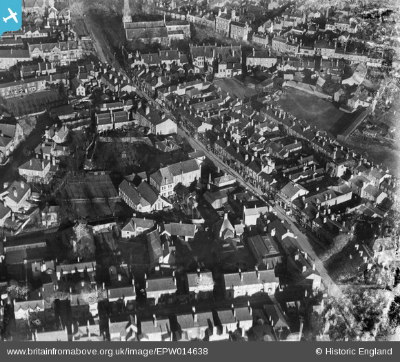
EPW014638 ENGLAND (1925). Evesham Street and environs, Redditch, 1925
© Copyright OpenStreetMap contributors and licensed by the OpenStreetMap Foundation. 2026. Cartography is licensed as CC BY-SA.
Nearby Images (6)
EPW014638

EPW014642

EPW005379

EPW005376

EPW005378

EPW014640

Details
| Title | [EPW014638] Evesham Street and environs, Redditch, 1925 |
| Reference | EPW014638 |
| Date | 10-December-1925 |
| Link | |
| Place name | REDDITCH |
| Parish | |
| District | |
| Country | ENGLAND |
| Easting / Northing | 404052, 267478 |
| Longitude / Latitude | -1.9405659666389, 52.305015357737 |
| National Grid Reference | SP041675 |
Pins

Ray Flack |
Wednesday 21st of January 2015 02:47:11 PM | |
|
Ray Flack |
Wednesday 21st of January 2015 02:46:13 PM | |
|
Ray Flack |
Wednesday 21st of January 2015 02:43:50 PM | |
 |
Ray Flack |
Wednesday 21st of January 2015 02:40:46 PM |
|
Ray Flack |
Wednesday 21st of January 2015 02:25:46 PM | |

Class31 |
Wednesday 3rd of September 2014 02:34:24 PM |
