
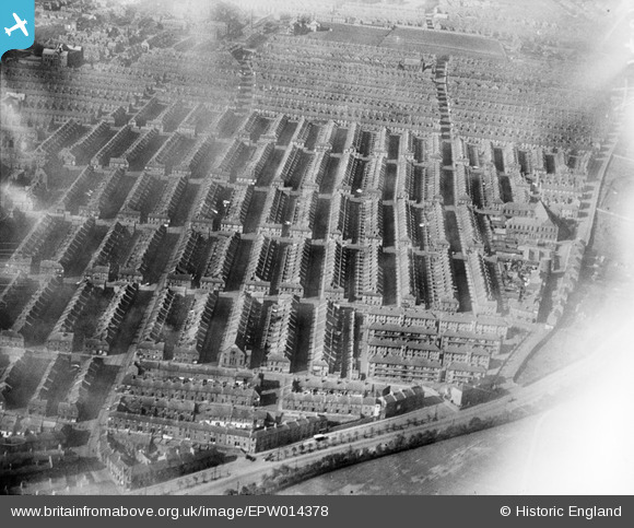
EPW014378 ENGLAND (1925). Housing terraces around Stanhope Street and environs, Newcastle upon Tyne, 1925
© Copyright OpenStreetMap contributors and licensed by the OpenStreetMap Foundation. 2025. Cartography is licensed as CC BY-SA.
Nearby Images (6)
EPW014378

EPW037102

EPW037106

EPW037103

EPW037105

EPW037104

Details
| Title | [EPW014378] Housing terraces around Stanhope Street and environs, Newcastle upon Tyne, 1925 |
| Reference | EPW014378 |
| Date | October-1925 |
| Link | |
| Place name | NEWCASTLE UPON TYNE |
| Parish | |
| District | |
| Country | ENGLAND |
| Easting / Northing | 423668, 564713 |
| Longitude / Latitude | -1.6301860543879, 54.976389045103 |
| National Grid Reference | NZ237647 |
Pins

Hevsta |
Monday 12th of October 2015 10:17:42 PM | |
|
Hevsta |
Monday 12th of October 2015 10:16:14 PM | |
|
MB |
Tuesday 25th of September 2012 04:51:22 PM | |
|
MB |
Tuesday 25th of September 2012 04:50:36 PM | |
|
MB |
Tuesday 25th of September 2012 04:48:43 PM | |
|
MB |
Tuesday 25th of September 2012 04:48:02 PM | |
|
MB |
Tuesday 25th of September 2012 04:46:23 PM | |
|
MB |
Tuesday 25th of September 2012 04:45:45 PM | |
Since rebuilt at the Black Bull public house |
MB |
Tuesday 25th of September 2012 05:00:39 PM |
|
MB |
Tuesday 25th of September 2012 04:37:45 PM | |
|
MB |
Tuesday 25th of September 2012 04:36:22 PM | |
|
MB |
Tuesday 25th of September 2012 04:35:46 PM | |
|
MB |
Tuesday 25th of September 2012 04:35:08 PM | |
Methodist |
MB |
Tuesday 25th of September 2012 04:49:58 PM |
User Comment Contributions
Looking west. Most of the housing here, built in the latter half of the nineteeth century, has been demolished and new housing erected. The gridded streets - at least up to those running laterally in this view - have gone. It can't have been the best environment to live in |
MB |
Tuesday 25th of September 2012 05:04:08 PM |