
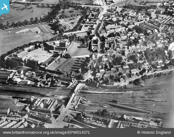
EPW014371 ENGLAND (1925). Annetwell Street and Carlisle Castle, Carlisle, 1925. This image has been produced from a copy-negative.
© Copyright OpenStreetMap contributors and licensed by the OpenStreetMap Foundation. 2026. Cartography is licensed as CC BY-SA.
Nearby Images (10)
EPW014371

EAW009320

EAW009323

EAW014517

EAW009321

EAW009319

EAW014516

EAW009318

EAW009322

EAW014518

Details
| Title | [EPW014371] Annetwell Street and Carlisle Castle, Carlisle, 1925. This image has been produced from a copy-negative. |
| Reference | EPW014371 |
| Date | 24-September-1925 |
| Link | |
| Place name | CARLISLE |
| Parish | |
| District | |
| Country | ENGLAND |
| Easting / Northing | 339700, 556094 |
| Longitude / Latitude | -2.9403223304504, 54.895851253786 |
| National Grid Reference | NY397561 |
Pins

RichardG |
Thursday 28th of June 2018 05:00:59 PM |