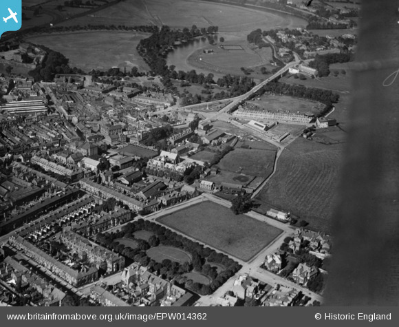
EPW014362 ENGLAND (1925). Chatsworth Sqaure North, Lowther Street and environs, Carlisle, 1925. This image has been produced from a print.
© Copyright OpenStreetMap contributors and licensed by the OpenStreetMap Foundation. 2026. Cartography is licensed as CC BY-SA.
Details
| Title | [EPW014362] Chatsworth Sqaure North, Lowther Street and environs, Carlisle, 1925. This image has been produced from a print. |
| Reference | EPW014362 |
| Date | 24-September-1925 |
| Link | |
| Place name | CARLISLE |
| Parish | |
| District | |
| Country | ENGLAND |
| Easting / Northing | 340307, 556221 |
| Longitude / Latitude | -2.9308844511471, 54.897065373957 |
| National Grid Reference | NY403562 |
Pins
Be the first to add a comment to this image!


![[EPW014362] Chatsworth Sqaure North, Lowther Street and environs, Carlisle, 1925. This image has been produced from a print.](http://britainfromabove.org.uk/sites/all/libraries/aerofilms-images/public/100x100/EPW/014/EPW014362.jpg)
![[EPW056222] Creighton Boys School and Margaret Sewell Girls School (Trinity School) under construction, Carlisle, 1937](http://britainfromabove.org.uk/sites/all/libraries/aerofilms-images/public/100x100/EPW/056/EPW056222.jpg)
![[EPW056216] Creighton Boys School and Margaret Sewell Girls School (Trinity School) under construction, Eden Bridge and The Swifts, Carlisle, from the south-east, 1937](http://britainfromabove.org.uk/sites/all/libraries/aerofilms-images/public/100x100/EPW/056/EPW056216.jpg)