
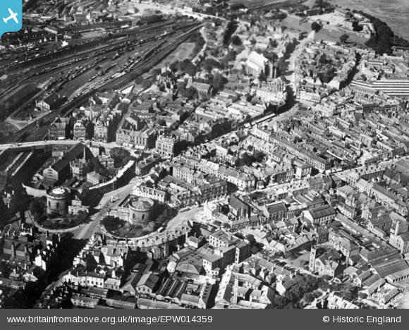
EPW014359 ENGLAND (1925). The Citadel and the city centre, Carlisle, 1925. This image has been produced from a copy-negative.
© Copyright OpenStreetMap contributors and licensed by the OpenStreetMap Foundation. 2026. Cartography is licensed as CC BY-SA.
Nearby Images (9)
EPW014359

EPW014370

EPW040207

EPW014357

EPW014374

EPW014361

EPW014351

EPW014363

EPW014373

Details
| Title | [EPW014359] The Citadel and the city centre, Carlisle, 1925. This image has been produced from a copy-negative. |
| Reference | EPW014359 |
| Date | 24-September-1925 |
| Link | |
| Place name | CARLISLE |
| Parish | |
| District | |
| Country | ENGLAND |
| Easting / Northing | 340176, 555761 |
| Longitude / Latitude | -2.9328314924999, 54.89291606413 |
| National Grid Reference | NY402558 |
Pins
Be the first to add a comment to this image!