
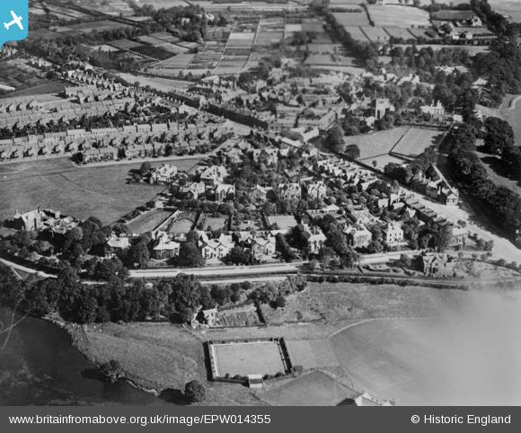
EPW014355 ENGLAND (1925). Cavendish Terrace and environs, Stanwix, 1925. This image has been produced from a copy-negative.
© Copyright OpenStreetMap contributors and licensed by the OpenStreetMap Foundation. 2026. Cartography is licensed as CC BY-SA.
Nearby Images (2)
EPW014355

EPW014365

Details
| Title | [EPW014355] Cavendish Terrace and environs, Stanwix, 1925. This image has been produced from a copy-negative. |
| Reference | EPW014355 |
| Date | 24-September-1925 |
| Link | |
| Place name | STANWIX |
| Parish | |
| District | |
| Country | ENGLAND |
| Easting / Northing | 339893, 556902 |
| Longitude / Latitude | -2.9374817856328, 54.903135325604 |
| National Grid Reference | NY399569 |
Pins

Philip |
Wednesday 20th of October 2021 11:41:13 AM | |
|
Philip |
Wednesday 20th of October 2021 11:40:02 AM | |
|
SueAT |
Wednesday 29th of April 2020 12:33:58 PM | |
|
SueAT |
Wednesday 29th of April 2020 12:33:36 PM | |
|
SueAT |
Wednesday 29th of April 2020 12:32:54 PM | |
|
SueAT |
Wednesday 29th of April 2020 12:31:04 PM | |
|
SueAT |
Wednesday 29th of April 2020 12:30:07 PM | |
|
SueAT |
Wednesday 29th of April 2020 12:24:49 PM |