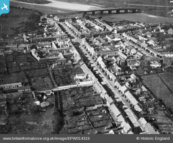
EPW014319 ENGLAND (1925). The town, Longtown, 1925. This image has been produced from a copy-negative.
© Copyright OpenStreetMap contributors and licensed by the OpenStreetMap Foundation. 2026. Cartography is licensed as CC BY-SA.
Details
| Title | [EPW014319] The town, Longtown, 1925. This image has been produced from a copy-negative. |
| Reference | EPW014319 |
| Date | 24-September-1925 |
| Link | |
| Place name | LONGTOWN |
| Parish | ARTHURET |
| District | |
| Country | ENGLAND |
| Easting / Northing | 338062, 568705 |
| Longitude / Latitude | -2.9685829056824, 55.00897347425 |
| National Grid Reference | NY381687 |
Pins

Billy Turner |
Wednesday 18th of November 2015 07:09:38 PM |


![[EPW014319] The town, Longtown, 1925. This image has been produced from a copy-negative.](http://britainfromabove.org.uk/sites/all/libraries/aerofilms-images/public/100x100/EPW/014/EPW014319.jpg)
![[EPW014318] The town, Longtown, 1925. This image has been produced from a print.](http://britainfromabove.org.uk/sites/all/libraries/aerofilms-images/public/100x100/EPW/014/EPW014318.jpg)
