
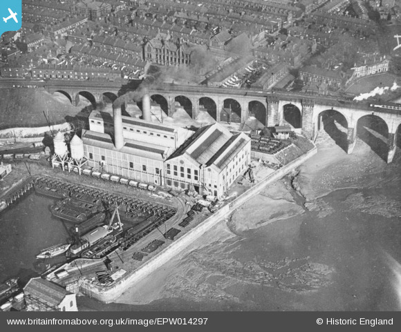
EPW014297 ENGLAND (1925). West Bank Power Station, Widnes, 1925. This image has been produced from a copy-negative.
© Copyright OpenStreetMap contributors and licensed by the OpenStreetMap Foundation. 2026. Cartography is licensed as CC BY-SA.
Nearby Images (14)
EPW014297

EAW044941

EAW049805

EAW044940

EAW049807

EAW049815

EAW008431

EAW049804

EAW049808

EAW044937

EAW044943

EAW046912

EAW008430

EAW049809

Details
| Title | [EPW014297] West Bank Power Station, Widnes, 1925. This image has been produced from a copy-negative. |
| Reference | EPW014297 |
| Date | September-1925 |
| Link | |
| Place name | WIDNES |
| Parish | |
| District | |
| Country | ENGLAND |
| Easting / Northing | 350928, 383808 |
| Longitude / Latitude | -2.7372416429034, 53.348615693147 |
| National Grid Reference | SJ509838 |
Pins

Bottom Yard |
Monday 12th of May 2025 05:07:35 PM | |
|
Bottom Yard |
Monday 12th of May 2025 05:05:10 PM | |

Ginger79 |
Saturday 28th of March 2020 12:46:09 AM | |
|
Ginger79 |
Friday 9th of August 2019 12:42:25 PM | |
|
Ginger79 |
Sunday 17th of January 2016 05:11:16 PM | |
|
Ginger79 |
Sunday 17th of January 2016 05:10:24 PM | |
|
Ginger79 |
Sunday 17th of January 2016 05:09:32 PM | |
|
Ginger79 |
Sunday 17th of January 2016 05:08:24 PM | |
|
David |
Sunday 31st of May 2015 07:48:59 PM | |
|
David |
Sunday 31st of May 2015 06:30:21 PM | |
|
David |
Sunday 31st of May 2015 06:27:24 PM | |
|
David |
Sunday 31st of May 2015 06:26:27 PM |

