
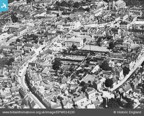
EPW014130 ENGLAND (1925). Carter Street and environs, Uttoxeter, 1925. This image has been produced from a copy-negative.
© Copyright OpenStreetMap contributors and licensed by the OpenStreetMap Foundation. 2026. Cartography is licensed as CC BY-SA.
Nearby Images (11)
EPW014130

EPW058390

EPW012625

EPW020037

EPW020035

EPW012626

EPW020036

EPW020033

EPW058413

EPW058388

EAW024747
, Uttoxeter, 1949. This image has been produced from a damaged negative.")
Details
| Title | [EPW014130] Carter Street and environs, Uttoxeter, 1925. This image has been produced from a copy-negative. |
| Reference | EPW014130 |
| Date | August-1925 |
| Link | |
| Place name | UTTOXETER |
| Parish | UTTOXETER |
| District | |
| Country | ENGLAND |
| Easting / Northing | 409111, 333366 |
| Longitude / Latitude | -1.8645465318955, 52.897340452621 |
| National Grid Reference | SK091334 |
Pins

D.R.B. |
Thursday 16th of November 2017 07:38:09 PM |