
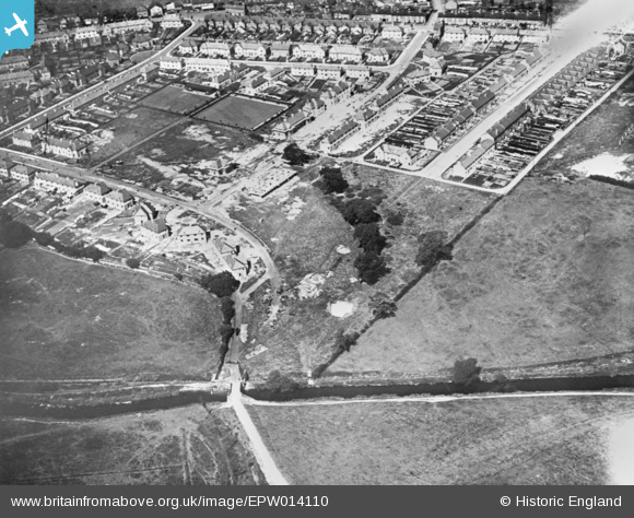
EPW014110 ENGLAND (1925). Construction of new housing around Fairway, Littleworth, 1925. This image has been produced from a copy-negative.
© Copyright OpenStreetMap contributors and licensed by the OpenStreetMap Foundation. 2026. Cartography is licensed as CC BY-SA.
Nearby Images (19)
EPW014110

EAW025545

EAW025983

EAW025984

EAW025987

EAW025544

EPW056771

EPW056767

EAW025542

EAW025982

EAW025548

EPW056766

EAW025989

EPW056768

EPW056770

EPW056764

EAW025547

EPW056765

EAW025597

Details
| Title | [EPW014110] Construction of new housing around Fairway, Littleworth, 1925. This image has been produced from a copy-negative. |
| Reference | EPW014110 |
| Date | August-1925 |
| Link | |
| Place name | LITTLEWORTH |
| Parish | |
| District | |
| Country | ENGLAND |
| Easting / Northing | 393378, 322995 |
| Longitude / Latitude | -2.0982387960855, 52.804137125684 |
| National Grid Reference | SJ934230 |
Pins
Be the first to add a comment to this image!