
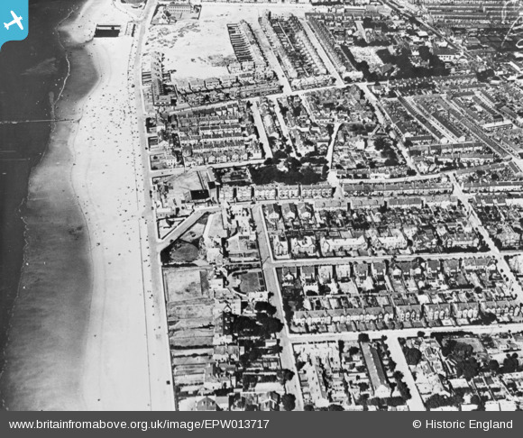
EPW013717 ENGLAND (1925). Alderley Road and environs, Hoylake, 1925. This image has been produced from a copy-negative.
© Copyright OpenStreetMap contributors and licensed by the OpenStreetMap Foundation. 2026. Cartography is licensed as CC BY-SA.
Nearby Images (2)
EPW013717

 0°
0m
0°
0m
EPW013718
 231°
296m
231°
296m
Details
| Title | [EPW013717] Alderley Road and environs, Hoylake, 1925. This image has been produced from a copy-negative. |
| Reference | EPW013717 |
| Date | 12-July-1925 |
| Link | |
| Place name | HOYLAKE |
| Parish | |
| District | |
| Country | ENGLAND |
| Easting / Northing | 321538, 389304 |
| Longitude / Latitude | -3.1800686507911, 53.394468534597 |
| National Grid Reference | SJ215893 |
Pins
 Was Hoylake Higher Elementary School built 1909 now The Parade, Hoylake Community Centre Was Hoylake Higher Elementary School built 1909 now The Parade, Hoylake Community Centre |

Clangerbird |
Tuesday 25th of September 2018 07:56:44 AM |