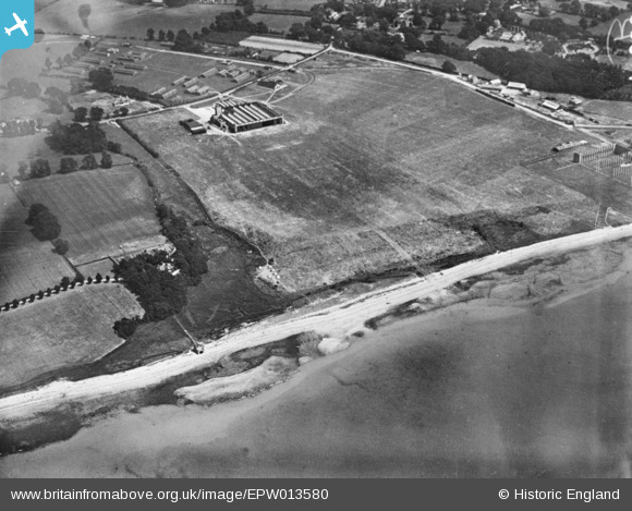
EPW013580 ENGLAND (1925). Hamble Airfield, Hamble-le-Rice, 1925. This image has been produced from a copy-negative.
© Copyright OpenStreetMap contributors and licensed by the OpenStreetMap Foundation. 2026. Cartography is licensed as CC BY-SA.
Details
| Title | [EPW013580] Hamble Airfield, Hamble-le-Rice, 1925. This image has been produced from a copy-negative. |
| Reference | EPW013580 |
| Date | June-1925 |
| Link | |
| Place name | HAMBLE-LE-RICE |
| Parish | HAMBLE-LE-RICE |
| District | |
| Country | ENGLAND |
| Easting / Northing | 447375, 106585 |
| Longitude / Latitude | -1.3268596635695, 50.856277727019 |
| National Grid Reference | SU474066 |
Pins
User Comment Contributions
Looking north west along the foreshore, Hamble, 20/03/2015 |

Class31 |
Saturday 21st of March 2015 05:18:02 PM |


![[EPW013580] Hamble Airfield, Hamble-le-Rice, 1925. This image has been produced from a copy-negative.](http://britainfromabove.org.uk/sites/all/libraries/aerofilms-images/public/100x100/EPW/013/EPW013580.jpg)
![[EPW009062] The Avro Factory, Hamble-le-Rice, 1923](http://britainfromabove.org.uk/sites/all/libraries/aerofilms-images/public/100x100/EPW/009/EPW009062.jpg)
![[EPW022948] The Avro Factory and aerodrome, Hamble-le-Rice, 1928](http://britainfromabove.org.uk/sites/all/libraries/aerofilms-images/public/100x100/EPW/022/EPW022948.jpg)